NOVA IMS and GEO-C team are pleased to welcome the visit of Dr. Viswanath Venkatesh

Dr. Viswanath Venkatesh is a worldwide renowned academic researcher and authority in the field of Information Systems with nearly 80000 citations in Google scholar. He was invited by the GEO-C team to visit NOVA IMS school on 03 and 04 of July 2018 to deliver a seminar and provide feedback to improve the research of Mijail Naranjo-Zolotov (esr05).

Title of seminar: “Road to success: A guide for doctoral students and junior faculty members in the behavioral and social sciences”

Seminar with Prof. Viswanath Venkatesh: "The road to success"


Biography: Viswanath Venkatesh, who completed his PhD at the University of Minnesota in 1997, is a Distinguished Professor and Billingsley Chair in Information Systems at the Walton College of Business, University of Arkansas. He is widely regarded as one of the most influential scholars in business and economics, both in terms of premier journal publications and citations. His research focuses on understanding the diffusion of technologies in organizations and society.

Reproducible Research and Industrial Property Rights Protection: A Success Experience in Indoor Positioning

You all are cordially invited to attend a lecture talk “Reproducible Research and Industrial Property Rights Protection: A Success Experience in Indoor Positioning” by Dr. Joaquín Torres, Postdoc at Geotec and Visiting Researcher at CCG.

Abstract: Reproducible resarch and Open Science are concepts that should applear in researchers CV. Donating collected datasets and experimental data boost the disemination of the projetcs and research. Providing the methods implementation as supplementary materials enables the research community to perform fair comparisons and doing important advances in the research topics. However this enters in conclict to one main objective of researchers, transferring technological and scientific findings to society. This seminar is intended to show a success case where open science and transfer have been successfully balances, following the premise of the EC “as open as possible, as closed as necessary”.


Where: Sala multiusos (UB1206SM), Espaitec2, UJI
When: July 5th and 6th 2018, from 11:00 to 14:00

Paper presented and published at WorldCIST 2018 Naples, Italy

WorldCist’18 – 6th World Conference on Information Systems and Technologies

Zolotov, M. N., Oliveira, T., Cruz-Jesus, F., & Martins, J. (2018, March). Satisfaction with e-participation: A Model from the Citizen’s Perspective, Expectations, and Affective Ties to the Place. In World Conference on Information Systems and Technologies (pp. 1049-1059). Springer, Cham.

Abstract

The diffusion and adoption of e-participation contributes to better democracy and more participative societies. Nevertheless, despite the potential benefits of e-participation, the level of citizen satisfaction regarding the use of e-participation and its effects on the continued intention to use have not been widely assessed yet in the literature. This article proposes a conceptual model that integrates the DeLone & McLean success model, that assesses the citizen satisfaction regarding the perception of the e-participation system quality; the expectation-confirmation model for the continued intention to use, which evaluates satisfaction based on the confirmation of ex-post experience on e-participation use and the perceived usefulness; and the dimensions of sense of place, which play a moderator role between the citizen satisfaction and the e-participation use.

SEVERAL WAYS TO #ENJOY #MAPS TALK BY @JOSEPHKERSKI AT #UJICAMPUS

Yesterday, March 21st,  GEOTEC received Prof. Joseph Kerski from the University of Denver and ESRI Education manager.

Kerski, renowned for his passion for GIS and Geography, gave a talk titled The world in your hands: the influence of maps in the information age . Joseph presented an easygoing talk addressed to all kind of audiences, centered in the main idea about the importance of “place” and “space” in the current society. Joseph showed how Geotechnologies are embedded in different services and applications of daily use.

Continue reading

Keynote Speakers: Open Data for Open Cities Workshop

Official website and Pre-registration: http://opendata4opencities.uji.es


Another week closer to the Open Data for Open Cities workshop and we’ve got another bundle of updates for you. This week, we are introducing our key notes speakers to you.


Cosmina Radu

Cosmina currently works as part of the European Data Portal flagship project where she assists the European Commission with the development of its annual EU Open Data Maturity Assessment and the promotion and development of Open Data strategies across EU member states, EFTA countries and EU accession candidates. She is also involved in providing strategy and technology consultancy services on aspects such as open data, the European data economy, as well as modernization of public administration and user-centric eGovernment. As part of the public sector cluster in Germany, Cosmina has assisted the successful implementation of several digital transformation projects in the field of eGovernment and eJustice at national level. You can find out more here.


Andrew Turner

Andrew is the current director and Chief Technical Officer (CTO) of ESRI’s Research and Development Center in Washington, DC. His work focuses on cross-domain collaboration and democratizing the map making process. Andrew is an active member of many organizations developing and supporting open standards such as the OpenStreetMap, Open Geospatial Consortium, Open Web Foundation, OSGeo and the World Wide Web Consortium. He is also the co-founder of CrisisCommons, a global community of volunteers leveraging technology to assist in building solutions for disaster response, recovery, and rebuilding. Andrew will be giving a keynote an open data portals built to meet the needs of citizens. He will also be leading a hands-on session on using open geospatial information to design data driven initiatives. You can find out more here.


We are also happy to announce that we have teamed up with the Information Journal of MDPI and the Information journal is the official media partner of the Open Data for Open Cities workshop. /Information/ is a fully open access journal published monthly online by MDPI. It is indexed by Scopus (Elsevier), Ei Compendex, Emerging Sources Citation Index (ESCI – Web of Science). You can find out more here


We are very excited and can’t wait to receive you in Lund, Sweden. Register here if you are yet to do so.


Notes on a participation in the meeting about “Citizen Science in Social Sciences and Humanities”

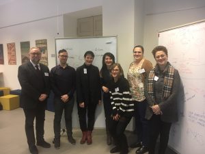
On the 7th and 8th of March, Manuel Portela (GEO-C ESR15) assisted to the meeting “Mapping opportunities and challenges for Citizen Science in Social Sciences and Humanities” as part of the COST Action “Citizen Science to promote creativity, scientific literacy, and innovation throughout Europe”. The meeting, held in the Kaunas University Of Technology (Lithuania) and organised by Egle Butkeviciene (KTU) and Katrine Vohland (MFM Berlin), gathered 15 participants from different fields inside Social Sciences and Humanities (SSH).

The aim of the meeting was to discuss the particularities of SSH inside the context of Citizen Science. Therefore, different sessions organised generated an agenda to promote the research on this topic.

The main concern of the meeting was the difficulty of including SSH scientists and citizens’ alike in research projects, despite of the promotion and support of funding agencies. It was also accounted that SSH has a large background in participatory practices, and a widely history on governance and engagement, which is nowadays of special interest for the (European) research agenda. As a result, one of the main barriers for transdisciplinarity could be the intrinsic difficulty of the object of study (objective, subjective and intersubjective, to name some). The lack of common ground, terminology and concepts inside the Sciences make this task unaffordable for both sides.

In this vein, Science is to create useful knowledge for society, whether the problem in the multidisciplinary approach resides in what data is considered valid (and objective) to be used for producing this Science. In that sense, Science is also useful in the use and understanding of such knowledge for more practical outcomes. Thus, in the literature, experts appear as the only ones who have the knowledge. In contrast, non-experts (i.e. citizens) are presented as the individuals that will use this knowledge for personal or collective purposes. Far from reality, this and other conflicts between concepts were put under discussion during the meeting.

The outcome of this meeting was to write a publication that accounts on how participatory practices and citizen involvement have been historically constructed. Moreover, the paper will also contribute to how SSH can help other sciences in the development of (European) projects. In this regard, SSHs has the mission to put the policies that are shaping the future of research under a critical view. By this first approach, it is expected to encourage more multidisciplinary and transdisciplinary works in Citizen Science.

@esri_spain workshops about #bigdata, #arcgis, #ML and much more

From February 21th to 22th, at Jaume I University – Castellon de la Plana (Spain) a set of courses were held by Esri Spain. Workshop’s main topics were about detecting spatial patterns, analyzing big data and applying ML with ArcGIS platform.

During two days over 20 students – from the Geo-C project and Mastergeotech students – attended the lectures given by Alberto Céspedes and Dariya Ordanovich from Esri Spain. By the presentation of several examples, Alberto and Dariya explained how concepts like Machine Learning, Spatial Big Data, and Spatial Patterns fit into ArcGIS.

Initially, Alberto Céspedes taught how to use Insights for ArcGIS creating easy-to-use dashboards which integrate spatial and tabular data for contextual analysis. Insights for ArcGIS is a web-based tool for data analytics that delivers an integrated view of the results, including charts, graphs, and maps.

The applicability of machine learning algorithms using ArcGIS tools was also presented during these workshops by the application of image detection for an extensive amount of satellite images. Geo-analytics tools from ArcGIS Pro provides a better understanding of an enormous amount of spatial data, integrating data web services with spatial geoprocessing tools.

Finally, Dariya Ordanovich illustrated how to connect, install and use R with ArcGIS, making use of the R-Bridge for ArcGIS. This open source project allows R users to work with ArcGIS data, and ArcGIS users to leverage the analysis capabilities of R.

For more information, about the tools used during this workshop, visit

“Integrating human specificities in the development of pedestrian navigation algorithms”, a talk by Dr. Valérie Renaudin.

On February 21, we enjoyed the visit of Dr. Valérie Renaudin, from the French Research Institute on Transport (IFSTTAR), in Nantes, France. She leads the Geopositioning Laboratory (GEOLOC) and chairs the next IPIN 2018 conference. Dr. Renaudin gave a lecture titled “Integrating human specificities in the development of pedestrian navigation algorithms”. In the talk, Dr. Renaudin introduced us to current problems and solutions of position estimation using inertial sensors measurements. She also described the advances she and her laboratory members have so far achieved in this regard, stressing the high complexity involved in creating a model that covers human gait features for everybody. In addition, Dr. Renaudin presented their experiences in using the combination of digital urban data and computer vision to improve inertial sensors-based position estimations. The combination is particularly applicable for augmented reality applications, where the user interaction provides extra information that is valuable for positioning. This invited lecture is part of the GEOTEC’s activities in the context of the GEO-C project.

USE AND DIFFUSION OF #RESEARCHDATA – A PANEL #JOBSEU2018

0The 7 th edition of the “Jornadas del Observatorio de Empleo universitario”, a workshop dedicated for the university employment observatory, took place in the Menador, a new building
in the city center shared by the University and the City Council. Carlos was invited to participate as a panellist in the panel called “Use and diffusion of data of employment insertion data: case of university graduates”. The scenery was fantastic: 3 panellists and the facilitator (right-most person below) in comfortable armchairs like talk shows that we usually watch on TV.

I tried to transmit 3 basic ideas to the audience, mostly university technicians who were expert in crafting questionnaires and analysing employment data.

Continue reading

The second version of the Open Data for Open Cities Workshop at the AGILE 2018 Conference – Call for Papers

Official website and Pre-registration: http://opendata4opencities.uji.es

21st AGILE International Conference on Geographic Information Science

Societal Geo-Innovation – Geospatial Technologies for All

Lund University-  Lund, Sweden 12 June 2018

1st CALL FOR PAPERS

Deadline: March 15, 2018

Continue reading