Paper Published in International Journal of Geo-Information IJGI – ISPRS about Roadblocks Hindering the Reuse of Open Geodata.

The paper Roadblocks Hindering the Reuse of Open Geodata in Colombia and Spain: A Data User’s Perspective (Authors: Fernando Benitez-Paez, Auriol Degbelo, Sergi Trilles, Joaquin Huerta) has been published in Volume 7, issue 1 of the International Journal of Geo-Information ISPRS by MDPI.

Abstract: Open data initiatives are playing an important role in current city governments. Despite more data being made open, few studies have looked into barriers to open geographic data reuse from a data consumer’s perspective. This article suggests a taxonomy of these barriers for Colombia and Spain, based on a literature review, an online questionnaire, and workshops conducted in four cities of these two countries. The taxonomy highlights that issues such as outdated data, low integration of data producers, published data being difficult to access, misinterpretation and misuse of released data and their terms of use are the most relevant from the data consumer’s point of view. The article ends with some recommendations to open data providers and research as regards steps to make open geographic data more usable in the countries analyzed.

This article is Open Access anyone can read and download anytime. For more information, to download, cite or read this recently published paper: http://www.mdpi.com/2220-9964/7/1/6

Cite: Benitez-Paez F, Degbelo A, Trilles S, Huerta J. Roadblocks Hindering the Reuse of Open Geodata in Colombia and Spain: A Data User’s Perspective. ISPRS International Journal of Geo-Information. 2018; 7(1):6.

Keynote Speakers: Open Data for Open Cities Workshop

Official website and Pre-registration: http://opendata4opencities.uji.es


Another week closer to the Open Data for Open Cities workshop and we’ve got another bundle of updates for you. This week, we are introducing our key notes speakers to you.


Cosmina Radu

Cosmina currently works as part of the European Data Portal flagship project where she assists the European Commission with the development of its annual EU Open Data Maturity Assessment and the promotion and development of Open Data strategies across EU member states, EFTA countries and EU accession candidates. She is also involved in providing strategy and technology consultancy services on aspects such as open data, the European data economy, as well as modernization of public administration and user-centric eGovernment. As part of the public sector cluster in Germany, Cosmina has assisted the successful implementation of several digital transformation projects in the field of eGovernment and eJustice at national level. You can find out more here.


Andrew Turner

Andrew is the current director and Chief Technical Officer (CTO) of ESRI’s Research and Development Center in Washington, DC. His work focuses on cross-domain collaboration and democratizing the map making process. Andrew is an active member of many organizations developing and supporting open standards such as the OpenStreetMap, Open Geospatial Consortium, Open Web Foundation, OSGeo and the World Wide Web Consortium. He is also the co-founder of CrisisCommons, a global community of volunteers leveraging technology to assist in building solutions for disaster response, recovery, and rebuilding. Andrew will be giving a keynote an open data portals built to meet the needs of citizens. He will also be leading a hands-on session on using open geospatial information to design data driven initiatives. You can find out more here.


We are also happy to announce that we have teamed up with the Information Journal of MDPI and the Information journal is the official media partner of the Open Data for Open Cities workshop. /Information/ is a fully open access journal published monthly online by MDPI. It is indexed by Scopus (Elsevier), Ei Compendex, Emerging Sources Citation Index (ESCI – Web of Science). You can find out more here


We are very excited and can’t wait to receive you in Lund, Sweden. Register here if you are yet to do so.


The second version of the Open Data for Open Cities Workshop at the AGILE 2018 Conference – Call for Papers

Official website and Pre-registration: http://opendata4opencities.uji.es

21st AGILE International Conference on Geographic Information Science

Societal Geo-Innovation – Geospatial Technologies for All

Lund University-  Lund, Sweden 12 June 2018

1st CALL FOR PAPERS

Deadline: March 15, 2018

Continue reading

GEO-C student wins best poster award in AGILE 2017 #agilewag2017

From May 9 to May 12, 2017, in Wageningen, The Netherlands, the 20th AGILE conference took place. This year’s team: societal geo-innovation.

AGILE 2017 is the annual international conference on Geographic information science of association of geographic information laboratories in Europe. This event, organized by Wageningen University and the remarkable local committee, was an excellent opportunity to discuss the social impact of geo innovation over the past 20 years, and the most exciting and challenging topics for the next 20 years in GIScience.

With more than 200 participants AGILE 2017 had pre-conferences workshops, parallel sessions, keynote sessions, and posters session, about the most significance GIScience topics such as VIG, Data Quality, Spatial analysis, Open Data, GeoGames, smart cities and others.

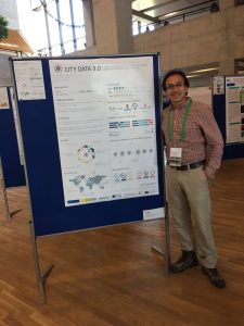
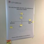
The poster session had more than 30 posters related to different topics. GeoC UJI was part of this event with two posters. Citizense – A generic user-oriented participatory sensing framework by  Manh Khoi Ngo, Luis Rodríguez and Sven Casteleyn and City Data 3.0 – A generic initiative to promote and assess the reuse of geographic information in cities – Early steps by Fernando Benitez and Joaquin Huerta. We are proud to say that the latter won the best poster award at Agile 2017!

City Data 3.0 poster presented the preliminary results of research related to the reuse and discoverability of available open data in cities. This poster shows the barriers identified in four selected cities, main data quality criteria considered by data consumers and the most valuable services and formats used for developers and analysts in Bogota, Cali, Medellin, and Valencia.


More GEO-C contributions in AGILE 2017:

  • Short Paper presentation: One tool to spatialize all – sense of place, social capital and civic engagement by Albert Acedo, Germán Martín Mendoza Silva, Marco Painho and Sven Casteleyn
  • Organization of 5th Open Data for Open Cities participatory workshop, Joaquin Huerta, Fernando Benitez, Mohammad Mehdi Moradi, Pau Aragó Galindo
  • Organization of Agile Workshop on Geogames and Geoplay, Christoph Schlieder, Miek Gould, Diego Pajarito, Ola Ahlqvist, Thomas Heinz, Peter Kiefer, Vyron Antoniou

GEO-C students organised 5th Open Data for Open Cities participatory workshop at Agile 2017 #agilewag2017

From May 9 to May 12, 2017, in Wageningen, The Netherlands, the 20th AGILE conference took place.

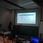
As part of the pre-conference program, GEO-C candidates  Mehdi Moradi (Esr12) and Fernando Benitez (Esr11) organized the 5th Open Data for Open Cities participatory workshop, which presented an opportunity to discuss about reuse and discoverability of open data in cities. Topics such as Crime, Disaster Management, Spatial point process and geo-portals assessment were part of the selected papers and a set of short presentations.

How data user barriers can impact the usefulness level of open data was the discussion with experts of Open Data during this workshop.  Participants included Professor Bastian van Loenen, associate professor in open data in the Department of Architecture and The Built Environment at Delft University of Technology, and Heleen Vollers, one of the authors of the last analytic report of European Data portal, who was the KeyNote speaker. Her talk about barriers and benefits of working with Open Data brought participants new insights about how several European countries and enterprises are using open data to improve their innovation level, as well as how cities should deal with barriers in data producer or consumer perspective. For more information about this presentation, you can check the workshop’s website.

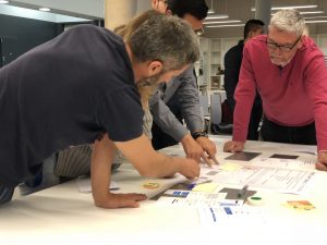
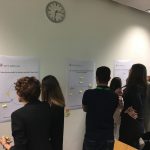
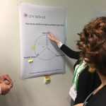
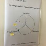
The afternoon session was more interactive, using wallpapers and some findings of City Data 3.0, participants covered three questions regarding reusing and finding open data.

  • Is the downloadable formats the effective way to promote the reuse of open data?
  • What should be the precise and efficient way to display data in open data portals?
  • Moreover, what should be the way to make the open data in cities available: through SDI portals, Open Data portals or both?

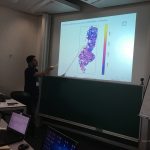
The last part of Open Data for Open Cities workshop was a point process analysis using the new methodology covered in the Ph.D. research of Mr. Moradi. Using Open Data from Medellin City in Colombia, related to car accidents, the last session was used to calculate an intensity network along streets of Medellin city. For more information about the methodology and steps to getting the results follow this link.

2nd CALL FOR PAPERS for Open Data for Open Cities Workshop at the AGILE 2017 Conference.

We invite all who want to be a part of a discussion on the real impact of Open Data in cities and spatial point analysis process on linear networks to present their works in our workshop.

Once the data consumers have access to open data, next step is to go depth and come up with practical methods of analysis together with accessible results for citizens.

Keynote Speaker:

We are very pleased to announce to our keynote speaker, Heleen Vollers. is a Senior Management Consultant at Capgemini Consulting. She works in the Public Insights & Data practice of Capgemini Consulting where she is a member of Capgemini’s global EU account.

Heleen is actively involved in the development of the European Data Portal and associated services, on behalf of the European Commission – DG CONNECT. Beyond being just a Portal, the project offers support services to countries as they mature on their Open Data journey. In addition, there is a strong focus on driving a user community and understanding the benefits of Open Data. Heleen leads the research work on measuring the level of Open Data maturity across Europe.


Continue reading

GeoTec Group and GeoC UJI presented several talks in last Esri Spain user conference.

img_7288 From October 26 to October 27, was held at Madrid the last Esri Spain User conference, the main event of Esri Spain company which meet together their customers, professors, some partners and students related to, GIS, smart Cities, Open Data, and GI applications that use Esri Technology.

During this couple of days, the Geotec research group and GeoC UJI presented several talks related to their projects and initiatives. Education track was the place to meet with some professors, Esri Master program students, and other people interested with the progress and success stories related to educations and GIS applications.

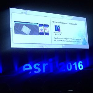
David Frias, who led the talks called, “NavApps: Un juego móvil para mejorar las habilidades espaciales en la ESO”, was the initial talk for GeoTec research group, Whom presented the process made for ENAbLE project. NavApps project is a geo-game with APP/Web application to improve the spatial skills of children from 12 to 16 years old, which is also part of ENAbLE project.

Continue reading

GEO-C ESR team won second place in the #NRWHackathon !

On February 27, 2016 in Düsseldorf, more than 80 participants including developers, researchers, administration officials, students, designers and programmers came together to create applications for “Education through Open Data”.

After a very interesting panel discussion from Claus Arndt (Moers), André J. Spang (Empress Augusta High School), Christian Dinnus (Open.NRW) and Hartmut Beuss (CIO NRW), the day unfolded into developing applications that use Open Data to educate children.

As participants, we selected our teams based on our interests and skills in the morning and worked all afternoon to develop those ideas as a group. It was a wonderful opportunity to get to work with new people and exchange ideas as well as improve them. I was part of the ”AmazingMapPeople”: an international team (Colombia and Germany) of eight people from two entities IFGI-Viderum-con terra as well as interested citizens.

Continue reading