Geo-C (UJI) And GEOTEC Attending Major Spatial Data Infrastructures Conferences In Barcelona

jiideoctFrom 26th to 30th September, Barcelona will host presentations and attendees from around world during Inspire Conference (http://inspire.ec.europa.eu/events/conferences/inspire_2016/page/home) and JIDEE (http://www.jiide.org/). These relevant conferences will gather European public authorities, private companies and Inspire community to show how the implementation of INSPIRE contributes to the European Interoperability Framework and the EU’s digital economy in general. http://inspire.ec.europa.eu/events/conferences/inspire_2016/page/home .

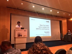
GEOTEC will present two papers inside JIDEE congress. The first of them is “Open City Toolkit: hacia ciudades más abiertas y participativas” and will be presented by Sergi Trilles. In this paper, Sergi will talk about Geo-C project and he will focus on the OCT tool. German will present “Soluciones para campañas mapeado de redes wifi” paper. In this paper, the author talk about a set of software solutions that aim to enable the general public to participate in WiFi signal samples collection campaigns.
GeoC – Spain, present in Vespucci Initiative 2016. Sensors, Smart Cities, Open Data and Mobility.

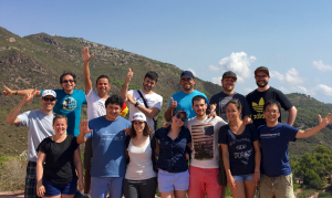
vespucciDuring the week September 5 to 9, 2016 in Benicassim – Spain, took place the second week of the Vespucci initiative, about sensors and mobile applications for smart cities. Where GeoC in Spain attended.

This summer school had as facilitators, as Michael Gould (Universitat Jaume I), Christian Sailer (ETH Zurich), Steve Liang (University of Calgary), Thomas Bartoschek (University of Münster).

With attenders of several countries such as Colombia, Spain, Switzerland, Greece, Germany, Cuba, Portugal. We had the opportunity to face interesting discussions of different topics, for instance, the real problem that we want to solve in our research topic, a business model for research projects, education and mobile learning, sensors, all those topics were covered using small groups for productive results and improve the local experiences.

Continue reading

GEO-C in Oxford Barracks Project

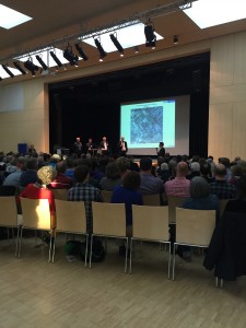
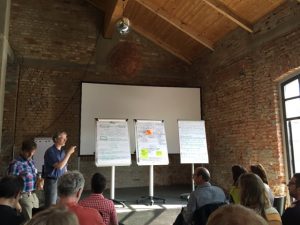
Stein GymnasiumOn April 7th, 2016, GEO-C in Muenster attended the public event of Oxford Barracks which was held by the city council of Muenster in Stein Gymnasium at Münster, Germany. This event was a dialogue between urban planners and citizens about an urban design for the zoning change of Oxford Barracks. Around 300 citizens attended this event.Lord Mayor Markus Lewe also attended the event.
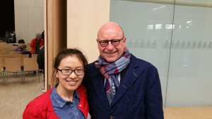
Professor Joachim Schultz-Granberg, who was representative of the urban design team, gave a presentation in this event. He reported an insight into ongoing work on the planning of Oxford Barracks. The event also served as early public participation in the planning for the purpose of Building Code, after the city council decided the establishment of the necessary development plan and the zoning change.

We carried a survey during the event by handing out questionnaires. The aim of

DU_Mayor_Lewethis survey was to collect background information of public participation in urban planning process. As a result 100 questionnaires and 30 email addresses from attendees were collected. We got the final survey results by analyzing questionnaires and sent them to citizens who gave their email addresses. Here is a short summary of the main survey facts:
  1. Being informed, and the willingness to have a say were the most important interests of our sample with respect to participation in planning processes
  2. Most of the people surveyed would like to use online surveys (or alternatively public events) to express their opinions
  3. Local newspapers remain the most important information medium as regards planning processes, followed by the Internet page of the Münster City Council
  4. Newsletter is the most mentioned technological option when asked about what method would facilitate their participation in planning processes
  5. Citizens expect more transparency and openness in urban planning process.

A pdf file with the final survey results is available here: http://www.geo-c.eu/results#surveys

Short Paper accepted for presentation @ UCAmI2016!

The paper with the title “Toolkits for Smarter Cities: A brief Assessment” (Authors: Auriol Degbelo, Devanjan Bhattacharya, Carlos Granell, Sergio Trilles) has been accepted for presentation at the 10th International Conference on Ubiquitous Computing and Ambient ?Intelligence UCAmI 2016!

Abstract: The literature has offered a number of surveys regarding the concept of smart city, but few assessments of toolkits. This paper presents a short analysis of existing smart city toolkits. The analysis yields some general observations about existing toolkits. The article closes with a brief introduction of the Open City Toolkit, a toolkit currently under development which aims at addressing some of the gaps of existing toolkits.

ifgi (WWU) participates in workshop on the future of the atlas

IMG_3333The Geovisualisation group at the Leibniz-Institut für Länderkunde, led by Francis Harvey, (http://www.ifl-leipzig.de/en/research/geovisualisation.html) organised a workshop to discuss the future of the atlas (http://atlaszukuenfte.nationalatlas.de, in German).  Not long ago, when someone wanted to access geographic information, they would reach for their atlas and look up what they were interested in.  With the proliferation of digital and online maps, many people now turn to readily available online services instead of their atlas.  Still, an atlas is more than just a collection of maps: it is carefully curated and the maps and diagrams it contains are usually of a very high quality.  The people creating an atlas also invest a lot of thought what (not) to include and which diagrams and maps to combine on a single page.  These useful aspects are frequently lost when transitioning to ‘vanilla’ online maps.

The two-day, by-invitation-only workshop at Leipzig (June 9th and 10th) brought together scientists and practitioners with different backgrounds, ranging from arts over literature, social sciences and cartography to geoinformatics and computer science.  At the event, several key aspects and challenges were discussed, including the role of curation, how people will want to interact with the atlas of the future and what economic models can fund atlas-related work.  Researchers from ifgi constituted the largest group of external experts and highlighted relevant issues such as transparency and openness, real-time sensor data and accessible user interfaces.

The 15 GEO-C PhD students meet in Lisbon for a “Retreat”

4579_foto5_7During next week, the 15 GEO-C PhD students will meet in Lisbon to “streamline” their approaches and to encourage cross-site cooperation. This “retreat” event has two different objectives:

  • Link to the PhD projects: On May 10, two external experts moderate a 90-minutes session with the PhD students. The two external experts agree on and formulate overall research questions in the context of smart cities and moderate its discussion with the PhD students. (Two sessions). Afterwards, PhD students will form working groups and in another 90-minutes session they come up with a project idea/proposal in this context, to be presented as elevator pitches. The next days the PhD students will do a hackathon on the “open city toolkit”.
  • Paper writing:  The idea is a discussion of the 4 external experts with the faculties of our Consortium about the role of software development in research and in PhD education. However, we do not only want to discuss, but to come up (ideally finish at the spot) a paper (or papers), so three full days (May 11, 12, 13) are dedicated to this approach.

During the week, while the PhD students will do a hackathon on the “open city toolkit”, the external experts and  the faculties of our Consortium will have “after-lunch visits” to  the PhD students, providing feedback to what they are doing. At the same time, this will be some “empirical feedback” to our paper writing.

Notes on Design & The City Conference: Controversies on Urban Participation and Participatory Sensing

CgpPa8KWYAAaopbIt is well known that participation and citizen engagement is a hard goal to accomplish in cities. Applied technologies to public participation have brought new opportunities to the field. Beyond all the good intentions, there are a lot of grey zones in what society have accomplished by engaging the public. The disappointments in SmartCity projects are usually related to tools that where designed or defined in narrow ways, giving only a unidirectional sense. And as Dorien De Molder pointed, the “Smart City discourse is normative”, It’s based on and reinforces particular beliefs about relationship between people, power and digital technologies.

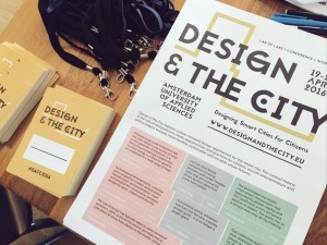
During the last week I attended to the Design and The City conference and workshops, in Amsterdam.
The event was curated by Martijn De Waal, who in his book “The city as Platform” gives us an idea on how the public context and technology are changing our perception about familiar places.

Continue reading

GEO-C ESR team won second place in the #NRWHackathon !

On February 27, 2016 in Düsseldorf, more than 80 participants including developers, researchers, administration officials, students, designers and programmers came together to create applications for “Education through Open Data”.

After a very interesting panel discussion from Claus Arndt (Moers), André J. Spang (Empress Augusta High School), Christian Dinnus (Open.NRW) and Hartmut Beuss (CIO NRW), the day unfolded into developing applications that use Open Data to educate children.

As participants, we selected our teams based on our interests and skills in the morning and worked all afternoon to develop those ideas as a group. It was a wonderful opportunity to get to work with new people and exchange ideas as well as improve them. I was part of the ”AmazingMapPeople”: an international team (Colombia and Germany) of eight people from two entities IFGI-Viderum-con terra as well as interested citizens.

Continue reading

Geotec (UJI) organises a geogames seminar for GEO-C students

Christoph Schlieder and Thomas Heinz from the Research Group on Computing in the Cultural Sciences, University of Bamberg, Germany (http://www.geogames-team.org/) gave a quite interesting 2-day course about geogames design and implemation. The first day there was an introductory presentation on Geogames, location based applications and its components. Some examples of gamification in a location based application were also shown, including Geoguessr, where you have to guess the location of a set of random pictures; and Geocaching, where there are treasures hidden in the real world, and only with the coordinates and some hints you should find them. In both cases you should try to get the best score by guessing the location or by finding more treasures. There was an explanation of two of their own Geogames, and after a demonstration, where we played with real devices on the campus of the University. The goal of the first one was to guess the distance between your current location to some buildings inside the campus. And the second game was a poker card game in which to change the cards in your hand you should move to an specific location in the campus; we were playing in two teams and the one who had better hand when the time was over won.

Continue reading

UJI organizes a Geogames seminar

In the context of Geo-C program, Geotec is organizing a geogames seminar for the next week (23 and 24). The seminar will take place in ESPAITEC II, Sala multiusos, 2nd floor (http://smart.uji.es/index.php?room=UB1206SM). And it will be taught by Christoph Schlieder and Thomas Heinz from the Research Group on Computing in the Cultural Sciences, University of Bamberg, Germany (http://www.geogames-team.org/).

geogames.fw

Continue reading