GEO-C student wins best poster award in AGILE 2017 #agilewag2017

From May 9 to May 12, 2017, in Wageningen, The Netherlands, the 20th AGILE conference took place. This year’s team: societal geo-innovation.

AGILE 2017 is the annual international conference on Geographic information science of association of geographic information laboratories in Europe. This event, organized by Wageningen University and the remarkable local committee, was an excellent opportunity to discuss the social impact of geo innovation over the past 20 years, and the most exciting and challenging topics for the next 20 years in GIScience.
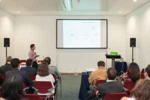
With more than 200 participants AGILE 2017 had pre-conferences workshops, parallel sessions, keynote sessions, and posters session, about the most significance GIScience topics such as VIG, Data Quality, Spatial analysis, Open Data, GeoGames, smart cities and others.

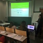
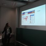
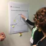
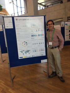
The poster session had more than 30 posters related to different topics. GeoC UJI was part of this event with two posters. Citizense – A generic user-oriented participatory sensing framework by  Manh Khoi Ngo, Luis Rodríguez and Sven Casteleyn and City Data 3.0 – A generic initiative to promote and assess the reuse of geographic information in cities – Early steps by Fernando Benitez and Joaquin Huerta. We are proud to say that the latter won the best poster award at Agile 2017!

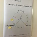
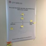
City Data 3.0 poster presented the preliminary results of research related to the reuse and discoverability of available open data in cities. This poster shows the barriers identified in four selected cities, main data quality criteria considered by data consumers and the most valuable services and formats used for developers and analysts in Bogota, Cali, Medellin, and Valencia.


More GEO-C contributions in AGILE 2017:

  • Short Paper presentation: One tool to spatialize all – sense of place, social capital and civic engagement by Albert Acedo, Germán Martín Mendoza Silva, Marco Painho and Sven Casteleyn
  • Organization of 5th Open Data for Open Cities participatory workshop, Joaquin Huerta, Fernando Benitez, Mohammad Mehdi Moradi, Pau Aragó Galindo
  • Organization of Agile Workshop on Geogames and Geoplay, Christoph Schlieder, Miek Gould, Diego Pajarito, Ola Ahlqvist, Thomas Heinz, Peter Kiefer, Vyron Antoniou
GEO-C students organised 5th Open Data for Open Cities participatory workshop at Agile 2017 #agilewag2017

From May 9 to May 12, 2017, in Wageningen, The Netherlands, the 20th AGILE conference took place.

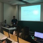
As part of the pre-conference program, GEO-C candidates  Mehdi Moradi (Esr12) and Fernando Benitez (Esr11) organized the 5th Open Data for Open Cities participatory workshop, which presented an opportunity to discuss about reuse and discoverability of open data in cities. Topics such as Crime, Disaster Management, Spatial point process and geo-portals assessment were part of the selected papers and a set of short presentations.

How data user barriers can impact the usefulness level of open data was the discussion with experts of Open Data during this workshop.  Participants included Professor Bastian van Loenen, associate professor in open data in the Department of Architecture and The Built Environment at Delft University of Technology, and Heleen Vollers, one of the authors of the last analytic report of European Data portal, who was the KeyNote speaker. Her talk about barriers and benefits of working with Open Data brought participants new insights about how several European countries and enterprises are using open data to improve their innovation level, as well as how cities should deal with barriers in data producer or consumer perspective. For more information about this presentation, you can check the workshop’s website.

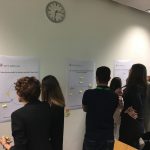
The afternoon session was more interactive, using wallpapers and some findings of City Data 3.0, participants covered three questions regarding reusing and finding open data.

  • Is the downloadable formats the effective way to promote the reuse of open data?
  • What should be the precise and efficient way to display data in open data portals?
  • Moreover, what should be the way to make the open data in cities available: through SDI portals, Open Data portals or both?

The last part of Open Data for Open Cities workshop was a point process analysis using the new methodology covered in the Ph.D. research of Mr. Moradi. Using Open Data from Medellin City in Colombia, related to car accidents, the last session was used to calculate an intensity network along streets of Medellin city. For more information about the methodology and steps to getting the results follow this link.

UJI shows the GEO-C project to two thousand students during the FIRAUJICIENCIA ’17

On April 6th, GEO-C UJI team (GEOTEC) has participated in the third edition of FIRAUJICIENCIA. There, we had the opportunity to show our project to more than around two thousand students and teachers. More than sixty workshops have filled the sports hall of the Universitat Jaume I with science. Also, GEOTEC showed other projects, like Sucre4Kids, where the students learn to program using electronic components and a visual programming language.
The scientific fair has gathered at the Universitat Jaume I students and lecturers from more than thirty educational centres throughout the province who have had the opportunity to learn more about dinosaurs, urban waste, electromagnetism, meteorites, water or robots.

Geo-C at UXMS meetup

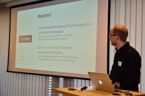
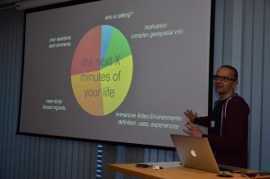
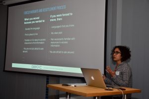
On March 29, 2017, it was held at ConTerra the first UX meetup (UXMS) in Münster (Germany). Two of the GEO-C team members from the University of Münster were part of the day with the talk called “UX for all: the case of complex geospatial information.” We discussed how to generate visualizations of geospatial information, as well as interactions with it through more inclusive and participatory approaches. As part of this, we introduced to the audience the overall goal of the GEO-C project and one of its research lines related to the adaptation of open geospatial data visualizations and interactions to support forced displaced population when arriving at an unfamiliar city for their resettlement process.


Call for PhD in Smart Sustainable Cities assessment framework is now open. Applications open until 14 April 2017

Eligibility Criteria

We target international and national holders of a Masters degree (or equivalent) related to GI. The field of Geoinformatics is interdisciplinary, so previous studies can be in GI or any GI application area, such as geography, ecology, transportation, forestry, energy provision, computer science, geology, etc., which is relevant for the research topic Sustainable Smart Cities assessment framework (see below).

Typically, the diploma/certificate confirming the completion of the Masters degree has to be submitted with the application documents. In exceptional cases, applicants can provide a transcript of records of the Masters program with courses attended so far. In that case he/she will provide the final diploma/certificate at the selection/interview phase. In case you don’t have your diploma by then but you are going to get it very soon, contact the supervisor to talk about your case.

Continue reading

The paper “Citizense – A generic user-oriented participatory sensing framework” has been accepted for publication in the International Conference on Selected topics in MoWNet’17

This paper, written by Ngo Manh Khoi, Luis E. Rodríguez-Pupo and Sven Casteleyn, described the general architecture of a generic participatory sensing framework that incorporates useful functionalities such as context-aware sensing, incentives for participants, an interactive dashboard for managing the content of the sensing campaign and viewing the results. The mobile client app (in Android) can also function as an offline data collecting tool.

Continue reading

“Ontdek je Buurt” awarded at the UX Linked Data Challenge

GEO-C participated in the UX Linked Data Challenge from November 3rd to December 2nd 2016. In particular, a member of the GEO-C consortium participated in the “Buying a house challenge”. The challenge aimed at increasing the business value of an online platform to rent, purchase, and sell houses, apartments, and commercial properties in the Netherlands. The team of the GEO-C researcher (Team members: Bart-Jan de Leuw, CGI;  Saskia van der Elst, Ordina; Gerard Persoon, Gpersoon bv; Auriol Degbelo, University of Muenster) built “Ontdek je Buurt” which won the award for the second place during the challenge. “Ontdek je Buurt” is a JavaScript Chrome extension which was developed using open source technologies and integrates existing open data (e.g., open street map data, childcare locations and topographical data from the Netherlands). It enables potential buyers (i.e. citizens) to explore neighbourhoods and find the most liveable place for them.